Jumara Fm
Type Locality and Naming
The type area lies along across country travel along village Jumara over Jumara Dome (Biswas, 1977)
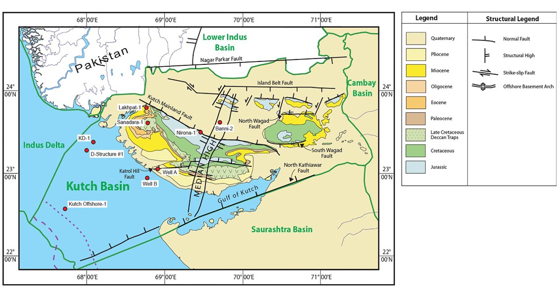
[Fig. Geological and structural map of Kutch, also showing the onshore and offshore wells drilled for oil exploration. (Map by Rasoul Sorkhabi in GeoExpro Dec2014, based on various sources including S.K. Biswas, Current Science, 25May2005)]
Lithology and Thickness
Claystone with an uppermost Oolite. In the type section it consists of Khaki, gypsiferous shale with thin marl bands. Towards top a thin fossiliferous, conglomeratic, oolitic marl band is present. Top of the formation is marked by Dhosa oolite member, which is also conglomeratic in nature. In subsurface bottom unit contains alternating micaceous shale, clay, impure limestone and calcareous shale. In the type section it is 273.5 m, in subsurface 121 to 725 m.
Relationships and Distribution
Lower contact
Defined by shale –limestone contact to underlying Jhurio Fm limestone.
Upper contact
Its uppermost Dhosa oolite member is unconformably overlain by the Jhuran Fm sandstone.
Regional extent
GeoJSON
Fossils
Brachiopods, Lamellibranches, Gastropods, corals are very common. The microfauna observed are Tewari kutchensis P.R.Z., and Proteonina diffugiformis- Astracolus anceps assemblage zone and Epistomina majungaensis R.Z. in the type section (Pandey and Dave, 1993).
Age
Depositional setting
Deposited in littoral (?) transgressive environment
Additional Information
